Just south of the leash-free zone in Raymore Park there’s a narrow rectangular strip of woodland that stretches below the houses along Westbank Crescent.
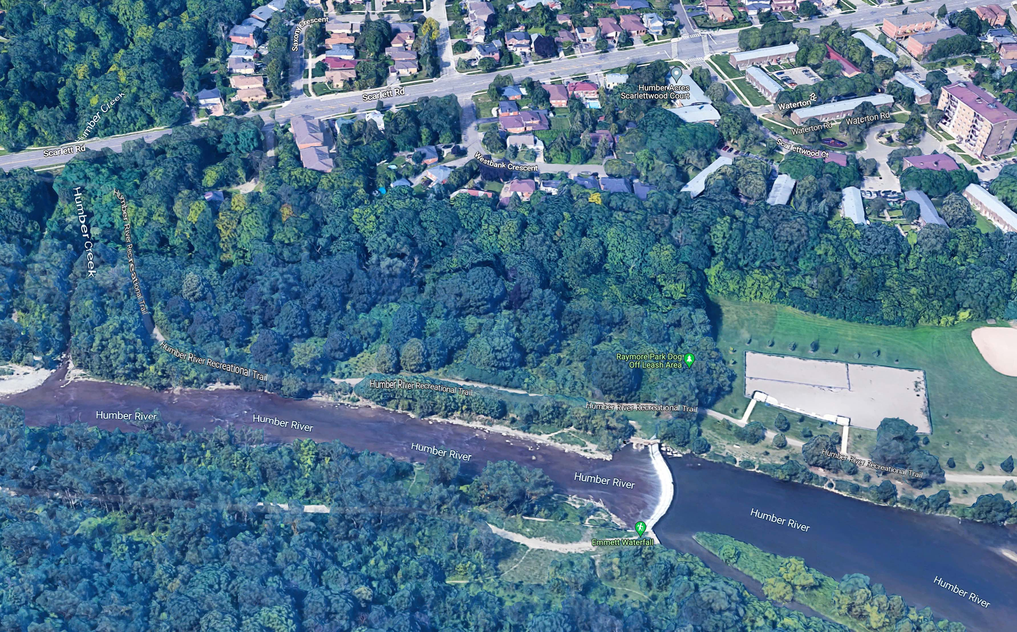
The strip extends down to Eglinton but the area in question ends at the Humber Creek and is about 200m long.
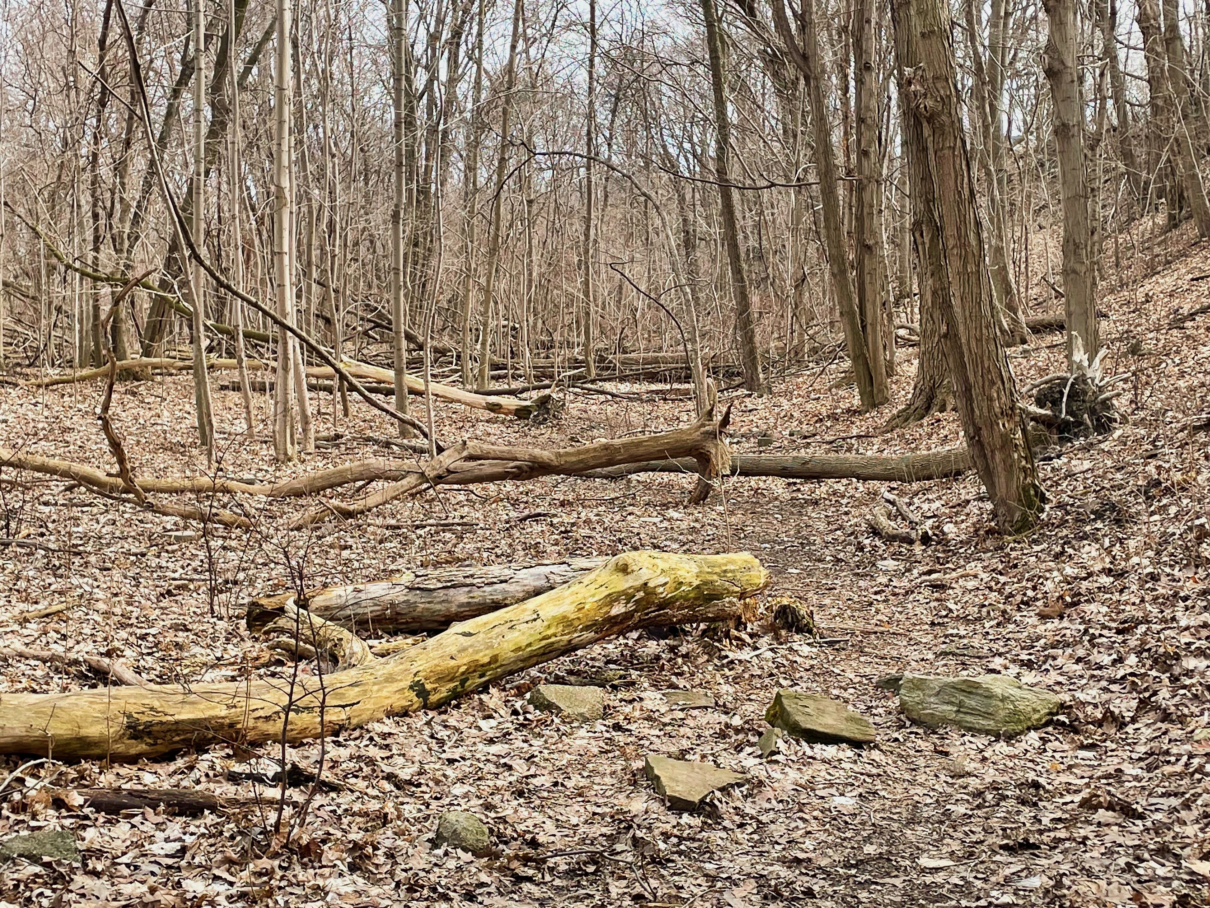
Inside this small flood-plain wood lie the trunks of many trees that have fallen – seemingly pushed over and uprooted by a strange and powerful force.
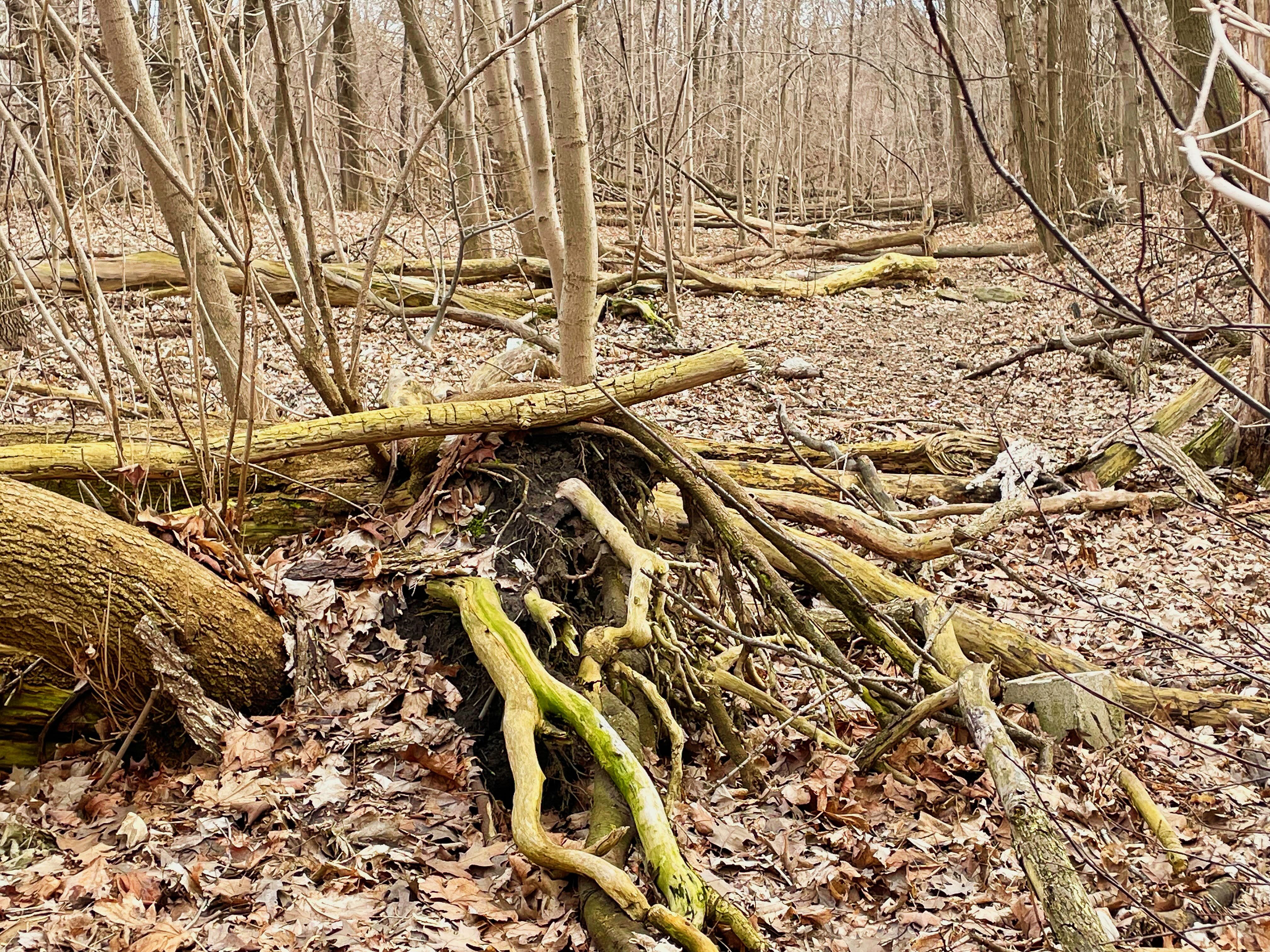
The downed trees are mainly at the base of the hill that rises up to Westbank Crescent and Scarlett Road (on the right in these images). This hill is thought to have been part of the shore of Lake Iroquois, which existed about 13,000 years ago.
This tree graphically illustrates the violence of what is going on.
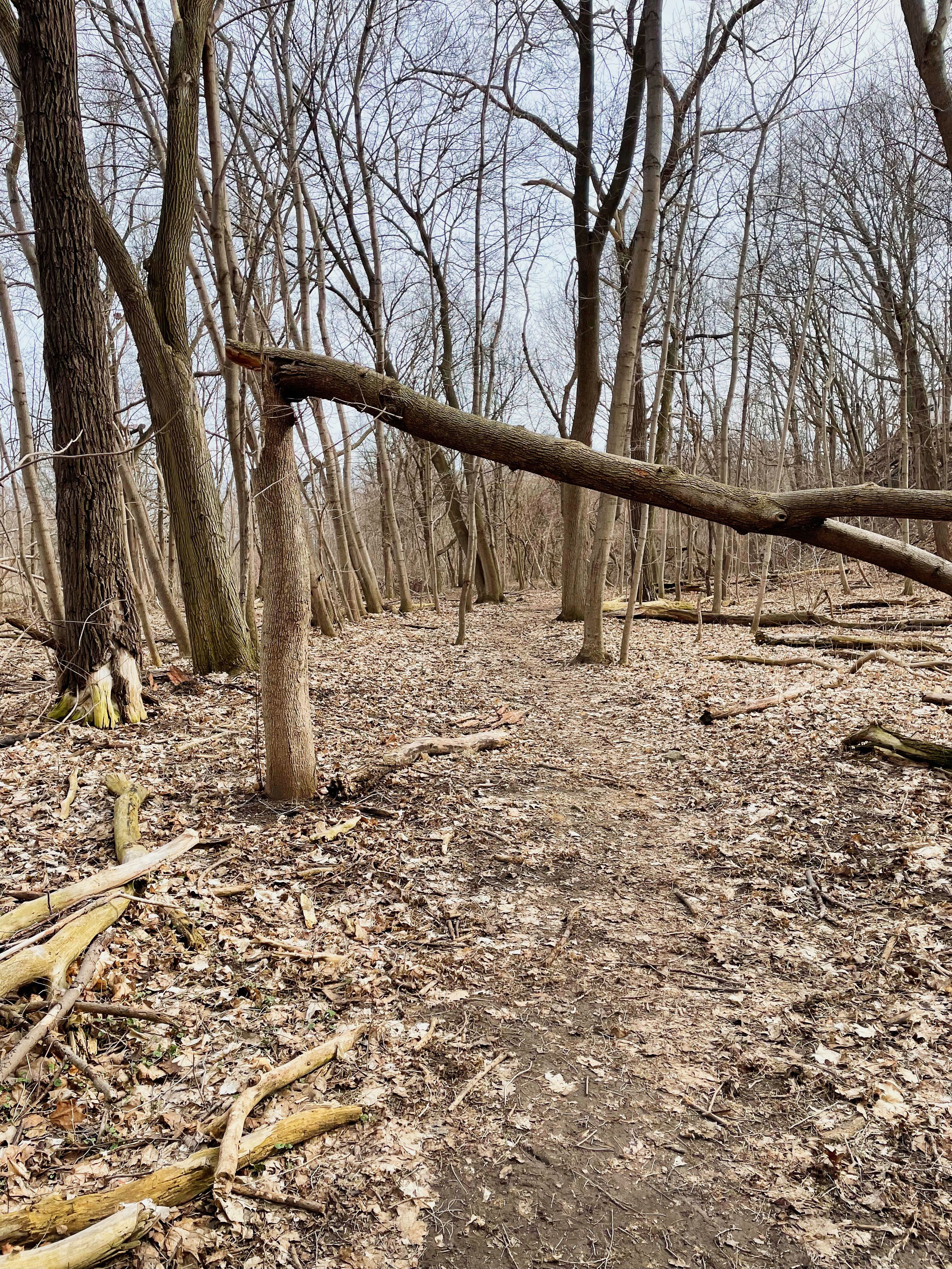
It looks as if the downward slope of the hill is helping to focus intense, violent downbursts and uprooting trees during summer thunderstorms when such wind gusts are common.
Why is the last tree bent over the opposite way to the others? I have no idea other than it might be some sort of rolling vortex that caught the top of the tree during a storm. It must have been a powerful gust.
Given the sheer quantity of downed trunks it might be wise to steer clear of this area when a summer storm is forecast.

