Tag Archives: Hurricane Hazel

Hazel Walk well attended.

Weston Historical Society's Cherri Hurst talks at the first stop on the tour.

Weston Historical Society’s Cherri Hurst (far right) talks at the first stop on the tour.

Close to 70 people attended last Saturday’s Hurricane Hazel Revisited walk. The guided tour stopped at many of the significant locations that played a part in the October 1954 tragedy that changed the face of Toronto. The walk was well received thanks to an excellent script that was a collaboration between Weston Historical Society members, Cherri Hurst and Mary-Louise Ashbourne.

I had the privilege of assisting in this Heritage Toronto walk and the level of interest among attendees was impressive. Hazel’s legacy is our precious park ravine and system; a place to enjoy nature as well as a haven for plant and animal wildlife.

Thanks to Jill for coming all the way from Burlington and adding a personal touch via her father’s incredible memories of being personally involved during the storm.

The rain held off until we began walking to the renovated St Matthias Church – now the Canadian headquarters for Sukyo Mahikari. We were shoehorned into the beautifully restored small church, dripping wet and were given a bonus presentation on the renovation of the church which played a part during Hazel’s aftermath.

Jane’s Walk May 3rd at 5:30pm

Jane's Walk2014-GB

On Saturday, May 3rd, a ‘Jane’s Walk’ will feature the Humber between Lions Park and the weir in Raymore Park. The emphasis will be on Hurricane Hazel and its effects on the environment both natural and human. Some of the stops along the way will be:

Stop 1: Lawrence Avenue Bridge

The effects of Hurricane Hazel and its deluge of water on the bridge and surroundings.

Stop 2: Lion’s Park / Weston Fairground

Stop 3: Raymore Foot Bridge

The history of the footbridge that once existed at this point and its current successor.

Stop 4: Raymore Drive (across bridge)

The ground where 36 people lost their lives; the role of the old bridge. View traces of the settlement that was destroyed.

Stop 5: Raymore Park

The aftermath of Hazel and the organization set up to acquire and manage flood plain land.

Stop 6: Raymore Park dam

The fish ladder and migrating trout. The future of weirs along the Humber.

Stop 7: Chapman Valley Park / Humber Creek

The flooding that occurred at the top of this creek on July 8 2013, and the impact development has had on rivers across the city

Stop 8:

Urban river valleys, the Greenbelt, and the upcoming staff report and vote in city council to add the Humber, Don, and Etobicoke Creek to the Greenbelt.

  • Option 1: Retrace our steps along the Humber path,
  • Option 2: walk through the streets, past the wooden church at Scarlett and Kingdom, down Raymore Drive, crossing back over Raymore bridge and ending back up at Lion’s Park.

Walk Leaders:

Mary Louise Ashbourne (Weston Historical Society)
Gaspar Horvath (TRCA)
Roy Murray (Humber Watershed Alliance)
Shelley Petrie (Friends of the Greenbelt)
Michael Cook (Lost Rivers)

Meeting point: Car park at Lawrence Avenue and Little Avenue (Cruickshank Park) at 5:30pm.


Hurricane Hazel Series- 1: The deadly knock

A knock on a door sealed the fate of two families on the rainy night of October 15, 1954. They lived on Raymore Drive in an idyllic neighbourhood by the shore of the Humber River. That night, radio stations had warned of a dangerous hurricane making its way north that would dump more heavy rain onto an already saturated ground.

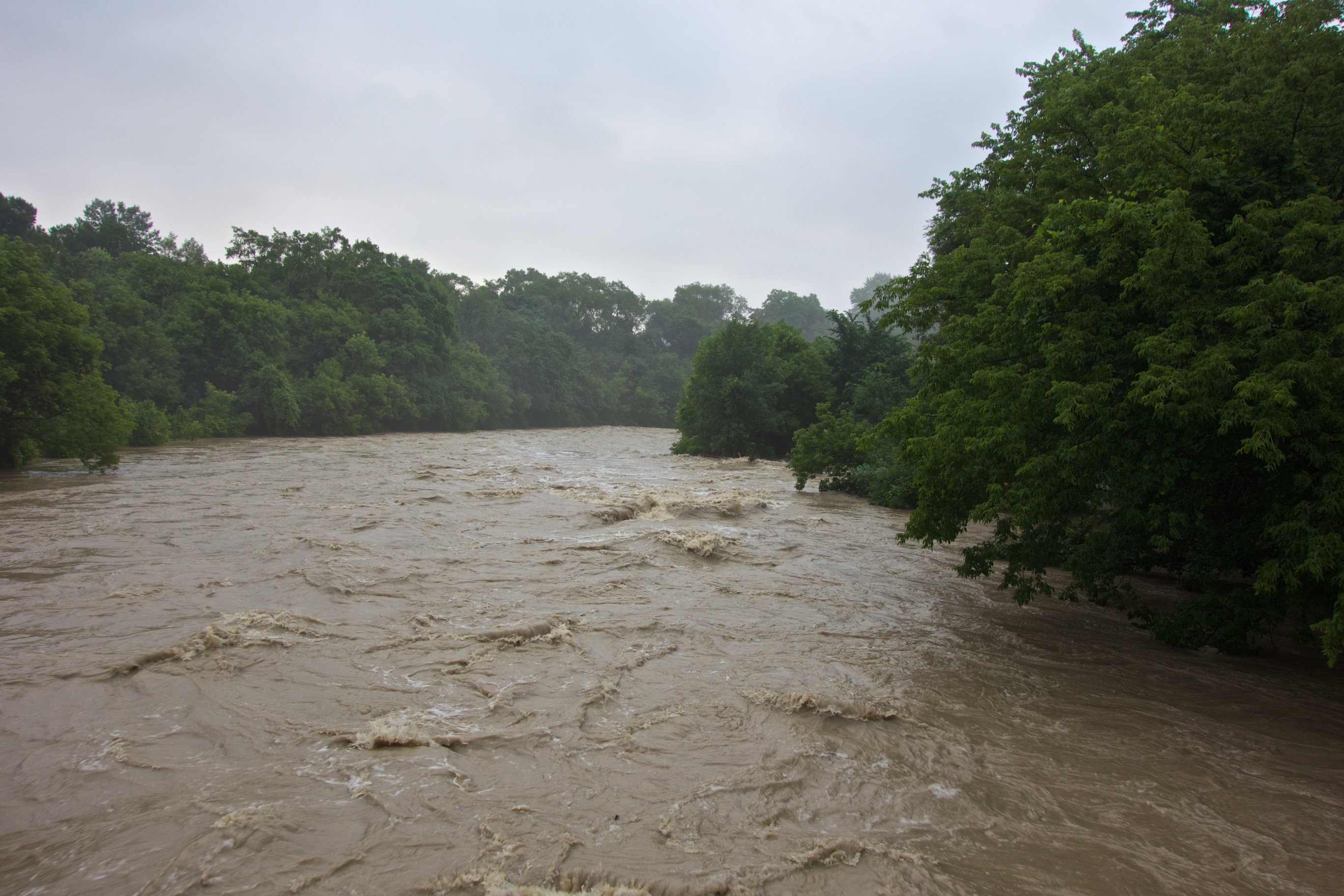
Autumn in Ontario is a time of transition. The province occasionally finds itself in the path of extra-tropical hurricanes that are usually shadows of their former selves by the time their energy supply of tropical air has been cut off. This hurricane, named Hazel, was different. It had wreaked havoc in many areas of the United States. Instead of becoming a rain event, Hazel managed to re-energize itself by finding and merging with a cold low pressure area and using that to squeeze out more wind and moisture.

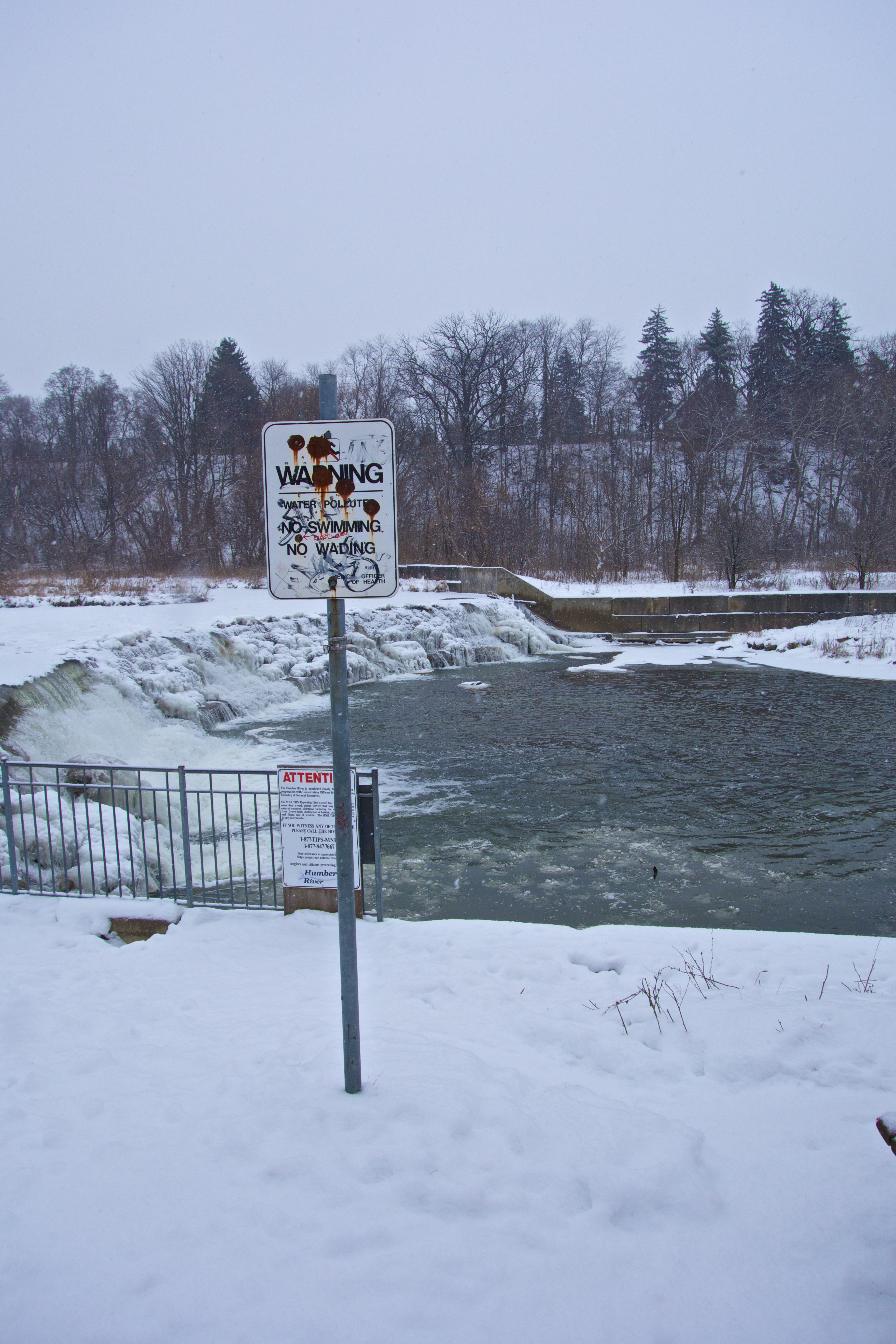
As the evening progressed, the storm parked itself over the city and the already swollen Humber River began to rise higher than residents had ever seen it. In wintertime, ice jams would bring water and inconvenience to the doorsteps of a few homes at the lower end of Raymore Drive but this time was different as the higher water level ceased to be an annoyance and started to become a threat. The roaring water surged wildly with no sign of levelling off.

As water lapped over thresholds into homes near by the river, one family thought it wise to ask neighbours on higher ground if they could bring over furniture threatened by the rising waters. This was the fatal knock. While the two families focussed on moving furniture to the higher house, their single-minded dedication to the task may have prevented them from acting quickly when events took a sudden turn for the worse.

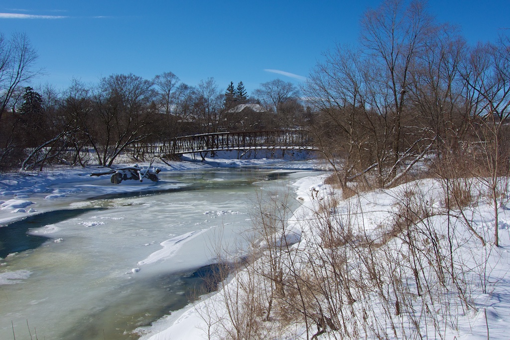
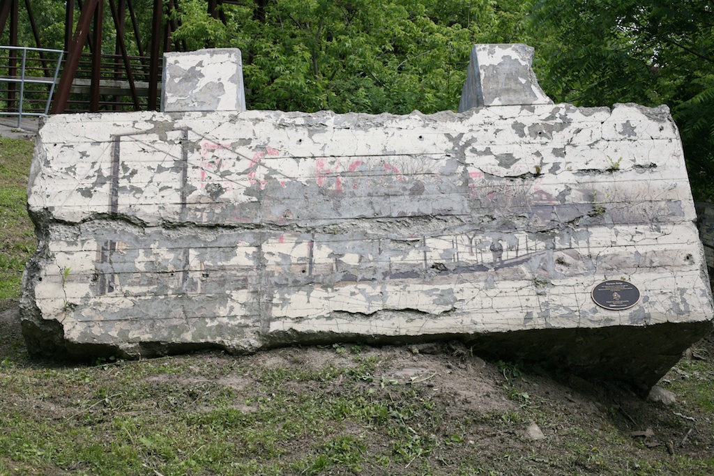
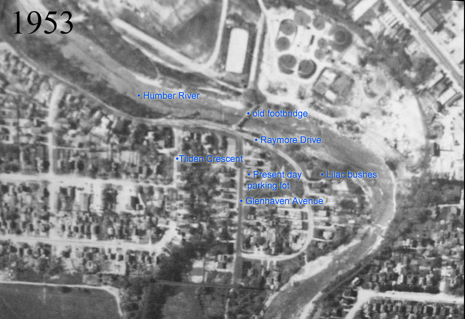
What neither family could see and what would end up costing the lives of 35 residents of the neighbourhood was an unpredictable turn of events. Straddling the river was a footbridge. It was then, as its replacement is today, a convenient short cut from Raymore Drive to the bustling town of Weston, a centre of commerce for miles around.

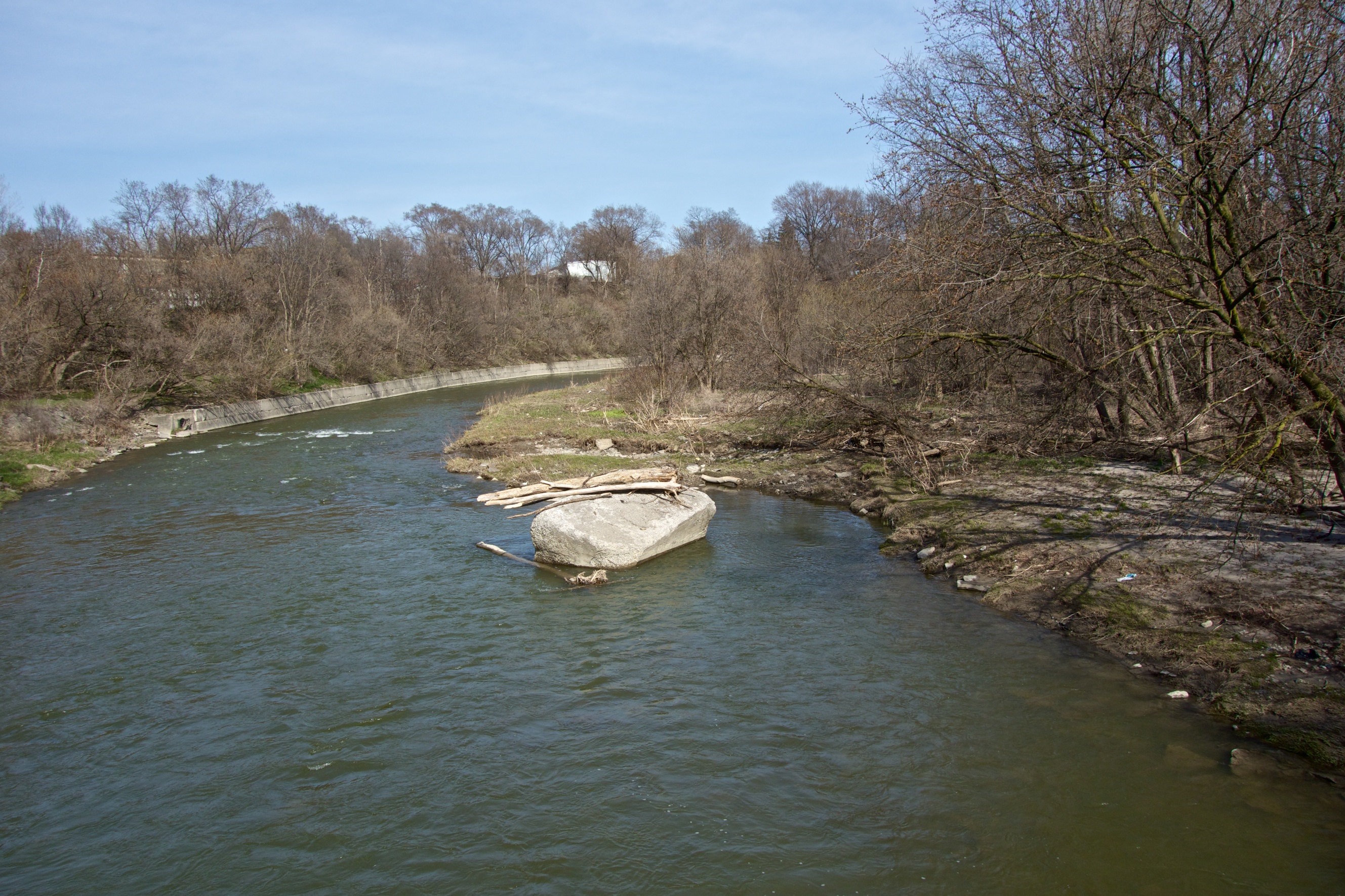
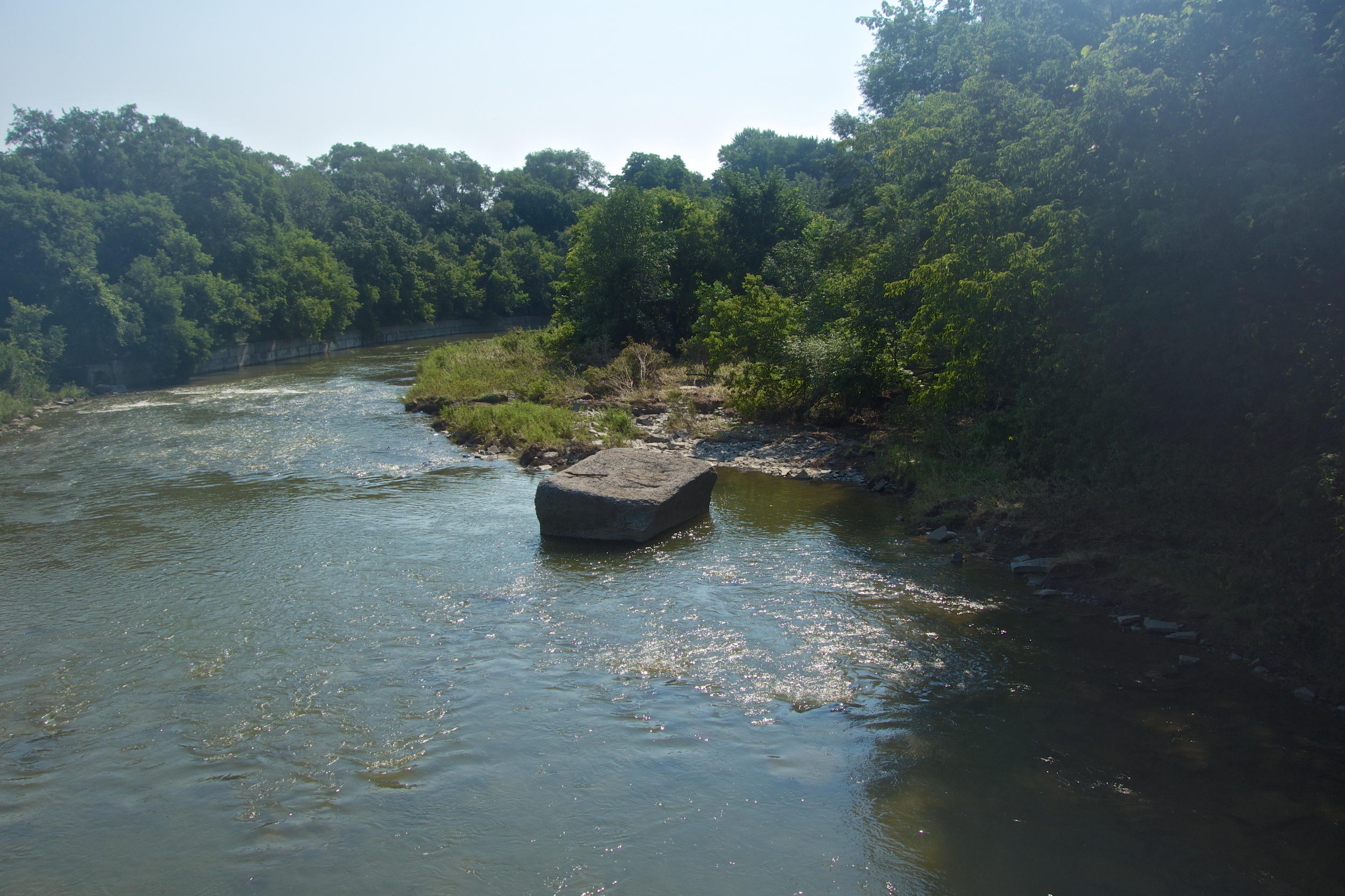
As the water continued to rise, the western abutment of the footbridge was dragged off its perch into the river a few metres downstream where it anchored itself in the position it occupies today. The structure of the bridge held and in effect, re-positioned itself diagonally across the river forming a barrier which, thanks to the debris washing downstream quickly became a diversionary dam. Suddenly and without warning, the river was steered directly into the path of the homes at the end of Raymore Drive engulfing our two families and taking a total of 35 lives at this location.

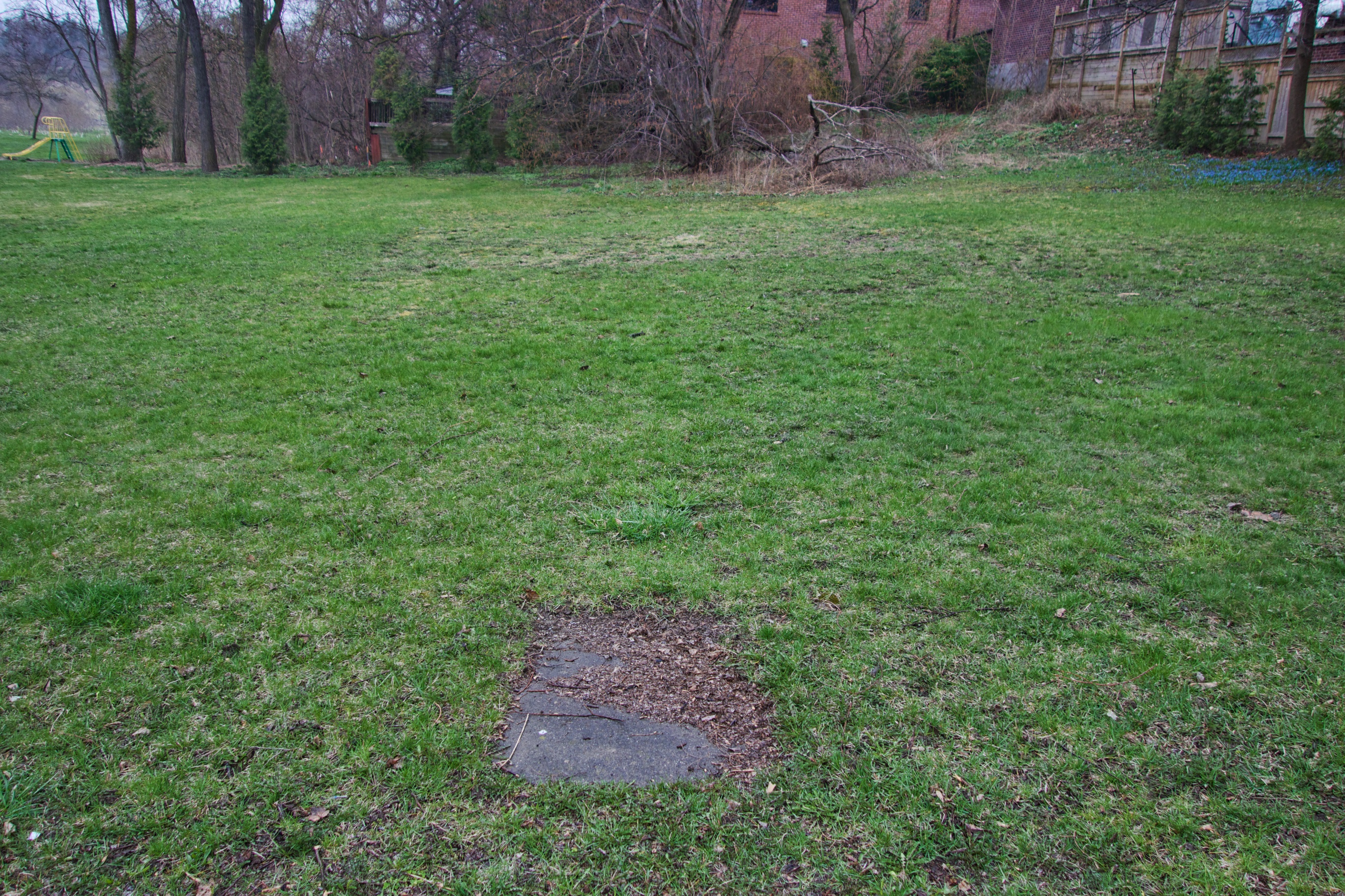
To this day, the western abutment remains in the river, standing as a grim witness to that terrible night. The eastern end of the bridge is also in place and as mentioned previously, was decorated with a (now badly peeled) commemorative mural in 2002. Raymore Park itself contains no memorial to the people who lost their lives that day. Perhaps this would be a worthy project.

Looking upstream, the western abutment is still in the Humber.

Looking upstream, the western abutment can be seen below and to the left of the bridge.

Readers are invited to add their own memories or anecdotes of Hurricane Hazel.

60 years since Hurricane Hazel

This year is the 60th anniversary of Hurricane Hazel. The night of October 15th, 1954 saw a storm that hugely affected many parts of Toronto and Southern Ontario. The epicentre of the tragedy was of course Raymore Drive where 35 residents died. In order to avoid such tragedies in the future, the Toronto and Region Conservation Authority was formed. This body was charged with setting aside flood-prone lands and creating the parks system that is a major feature of today’s Toronto.

To commemorate the anniversary, I’ll try and produce the occasional article on the topic until October. The first one will appear later this week.

The eastern abutment of the old footbridge connecting Weston to Raymore Drive.

The eastern abutment of the old footbridge connecting Weston to Raymore Drive. Artist Mario Noviello painted this commemorative work in 2002 but sadly the weather has not been kind to his creation showing the original suspension bridge. The western abutment remains in the river where it was dragged during Hazel’s fury.

Old footbridge abutment turned by big storm.

Its a subtle change but during the July 9th storm, the old bridge abutment was shifted backwards by the force of he river. The old bridge was destroyed in 1954 during Hurricane Hazel and the abutments have remained, more or less in place to this day. There is a strong theory that before its destruction, the bridge held together long enough to form a dam which sent the full force of the river from the bottom left of the picture into the small community living in the area to the right.

The before photo taken last April.

The ‘before’ photo taken this April.

The Humber in full flood, July 9, 2013

The same view with the Humber in full flood, July 9, 2013

The after photo taken July 23.

The ‘after’ photo taken July 23.

I have tried to take the comparison shot from the same viewpoint and with water levels roughly the same. To my untrained eye it looks as if not only has the big lump of concrete been rotated backwards by the force of water, it also seems as if it is riding higher, perhaps having been pushed onto higher ground.

Or maybe it’s my imagination…

More hints of the past

Housing was once scattered along the length of the Humber. Quite a few were built on the valley floor in present day Raymore Park. Raymore Drive used to stretch down into the present-day parking lot and Gilhaven Avenue. It must have been an idyllic location with nature close at hand, rich flood plain soil and an easy walk to the shops and transportation links in Weston. Interestingly, I was talking to long time Weston resident Douglas Tucker and he mentioned that until the mid-1960s, Weston was a shopping destination for people from as far away as Palgrave and Bolton thanks to a regular train service.

In Raymore Park, few traces remain of the houses once located here before they were either swept away during Hurricane Hazel or demolished by authorities in the aftermath. Every spring however, flowering shrubs are living reminders of the families who cultivated gardens here more than fifty years ago.

This beautiful lilac blooms faithfully every year.

This is one of two beautiful lilacs that bloom faithfully every year.

Apple blossom pokes its way through the surrounding trees.

Apple blossom pokes its way through the surrounding trees.

A beautiful American Honeysuckle towers over day lilies.

Along with the day lilies in front of it, I don’t know if this beautiful honeysuckle is a remnant or not.

This City of Toronto Archive aerial view has been labelled to show the location of some of the streets including Gilhaven Avenue which no longer exists. The present-day lilac bush and parking lot locations are marked. The Humber still follows the same approximate course.

Aerial view of Raymore and Glenhaven in 1953.

Aerial view of Raymore and Gilhaven in 1953.

Ghosts of the past

Every so often when weather conditions are just right, strange apparitions begin to form by the entrance to Raymore Park. These are the shapes of homes that lined Raymore and Gilhaven Drives until Hurricane Hazel brought devastation to the area in 1954. The houses at this location were untouched by the flooding but were purchased and demolished as a precaution. The basements were filled in and levelled. Part of an original concrete pathway still survives. The shape of the basements can be seen because the fill was different to the surrounding soil causing a variation in the plant cover. Based on the same principle, archaeologists often use aerial photographs when looking for ancient settlements.

The entranceway path and beyond, the faint basement outline.

An entranceway path and beyond, a faint basement outline.

Down by the dam.

Copyright © 2013 by Roy Murray, all rights reserved.

Frozen spray builds up on the steps of the dam. Can you see the sign to the left of the bench?

2013 01 03.

The dam in Raymore Park was one of several constructed after Hurricane Hazel in 1954. Designed to come into action during times of heavy rains, it’s purpose is to ease the pressure on downstream areas by flooding the nearby plain upstream. Unfortunately, this dam is so tall it blocks the passage of migrating fish. To solve this problem, a denil fishway (better known as a fish ladder) was constructed around 2000 at a cost of around $250,000. The idea is to allow migrating salmon and trout to climb this otherwise insurmountable barrier by building a series of easily managed concrete steps. Water flow is moderated using metal baffles at each step. The entrance to the fish ladder is on this side of the dam at the base of the falls and fish can be seen congregating there in spring and fall migrations (along with unscrupulous fishermen). The ladder was expensive and considerable ongoing maintenance is required before each migration to clear twigs and other debris placed there by opportunistic beavers. I always joke that it would have been cheaper to transport the fish by taxi.

The dam is a pretty sight in all seasons. However, just as people might think they are in some idyllic place – a nirvana in the city, the sign by the dam is designed to knock all that nonsense out of you.

Copyright © 2013 by Roy Murray, all rights reserved.

How many bullet holes can you count?

In addition to informing us that the water is polluted, somebody has told us that the sign is riddled with bullet holes by helpfully pointing out one of them. In other words, if the pollution in this beauty spot doesn’t get you; a cap in your ass might. I wonder who’s doing the polluting or if this ancient sign is relevant any more? Obviously this sign has just faded into the background and park officials no longer see it.

Copyright © 2013 by Roy Murray, all rights reserved.

This tourist moment is brought to you by…

That sounds like a job for me – phone the city and get it removed.

Winter digs in; 29 December 2012

Copyright © 2012 by Roy Murray, all rights reserved.

Humber River footbridge with an abutment of the old suspension footbridge bridge visible on the far left.

Another snowfall today and the view towards Raymore Park is very ‘picture postcard’ seasonal. This shot is taken during snow from Lions Park on the other side of the footbridge. This crossing over the Humber, installed in 1995 replaced the suspension footbridge that was swept away during Hurricane Hazel in 1954. The old footbridge was actually blamed for many of the deaths during the hurricane as it formed a dam and directed the flow of water towards housing on lower sections of Raymore and Gilhaven Drives. Interestingly, the abutments of what is probably the old bridge are close by the footbridge and still visible.

One abutment is on the Weston side and the other is currently hidden under the driftwood on the right bank in the second photograph.

The river flows quite quickly under the bridge and will take a few more days of these temperatures before freezing over. Downstream, around the bend, the river is already covered with ice.

Driftwood covers the abutment; centre right of the picture.

Looking downstream from the bridge.